
Project
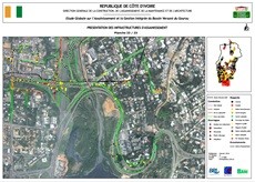
Comprehensive study on sanitation and integrated management of the Gourou watershed
GIS · Côte d'Ivoire
Project overview
The study proposes solutions to sustainably improve living and working conditions for people in the areas surrounding the Gourou watershed. Support to the French GIS expert covered data analysis, processing, integration and publication; thematic maps and atlases for the study area; orthophoto processing and mosaicking; and thematic map generation.
Key information
The context and mission details associated with this project.
- Domain
- GIS
- Country
- Côte d'Ivoire
- Client
- Ministry of Construction, Housing, Sanitation and Urban Development
- Mission duration
- 1 month
- Start date
- March 2015
- End date
- April 2015
A similar project? Let’s talk.
Tell us about your challenges: MODELIS TECH can help define an appropriate geomatics response.