
Project
Implementation of an information system for managing Côte d'Ivoire cadastral data
GIS · Côte d'Ivoire
Project overview
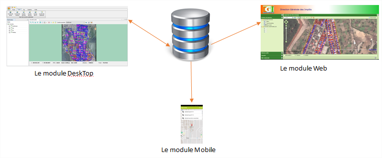
This project implements a consistent, modular information system for managing Côte d'Ivoire cadastral data. It relies on a single centralised database linking electronic cadastral documents and photographs to each parcel. It provides a desktop application for staff, a web application for decision-makers and a mobile application for field officers, managers, notaries and licensed surveyors. Key functions include searches by parcel ID, name, NCC, coordinates or land title; printing tax-status documents, cadastral extracts and location plans; and integrating additional data sources.
Key information
The context and mission details associated with this project.
- Domain
- GIS
- Country
- Côte d'Ivoire
- Client
- Cadastral Directorate
- Mission duration
- 6 months
- Start date
- October 2017
- End date
- June 2018
A similar project? Let’s talk.
Tell us about your challenges: MODELIS TECH can help define an appropriate geomatics response.